Drones, Sensors, and Beyond: Transforming the Way We See the World

As the age-old sayings go, seeing is believing, an image is worth 1000 words, or beauty is in the eye of the beholder. These concepts extend beyond the human perspective. As technology advances and drone sensors become more sophisticated, the eyes of a drone can see more than we ever expected. In this article, we'll look into these sensors, and how several industries are using them to gain new perspectives.
Drones, like humans, use their eyes to collect data about their environment. RGB cameras, aka red-green-blue cameras, are used to capture visual data in the same way the human eye perceives colour. These images can be used to create 2D maps & 3D models, allowing for fast, up-to-date analysis of large areas and projects that benefit almost any industry.
Thermal cameras detect and measure infrared radiation emitted from objects, allowing for the creation of thermal images. Thermal cameras used to be low resolution; however, in recent years advancements in technology have allowed for much higher-resolution thermal sensors. These sensors are now being used in applications such as search and rescue, firefighting, and building and equipment inspection where they can detect the body heat of a lost individual, hotspots in a wildfire, or anomalies in equipment that may indicate a potential problem.
Heat is radiated in the infrared spectrum and that is why infrared is useful in SAR missions and for wildfire, when detecting body heat, or the heat from hotspots. This video shows infrared footage of a prescribed burn that Hummingbird did with BCWS last summer.
Curious to see how infrared sensors, drones, firefighters and AI technology can come together to fight wildfires? Download a sample data package from fireai.io and create a map from infrared images captured by drone of a wildfire. These smart maps are being used by firefighters to detect dangerous “hotspots”, which will help them take down fires more safely and effectively.
Multispectral sensors collect data in multiple spectral bands beyond RGB, where Hyperspectral sensors collect detailed data on the specific spectral properties of materials. These sensors are used in agriculture for crop analysis, environmental monitoring, mineral exploration, and vegetation mapping. They provide next-level insight into crop health, monitoring water use, and detecting pests and diseases.
LiDAR, or Light Detection and Ranging, uses laser pulses to measure distances and create detailed 3D maps. LiDAR is used in various applications such as topographic mapping, surveying, and autonomous navigation. The benefit of LiDAR is its ability to penetrate dense foliage, reaching the ground layer that would otherwise be invisible from the sky using traditional alternatives like photogrammetry.
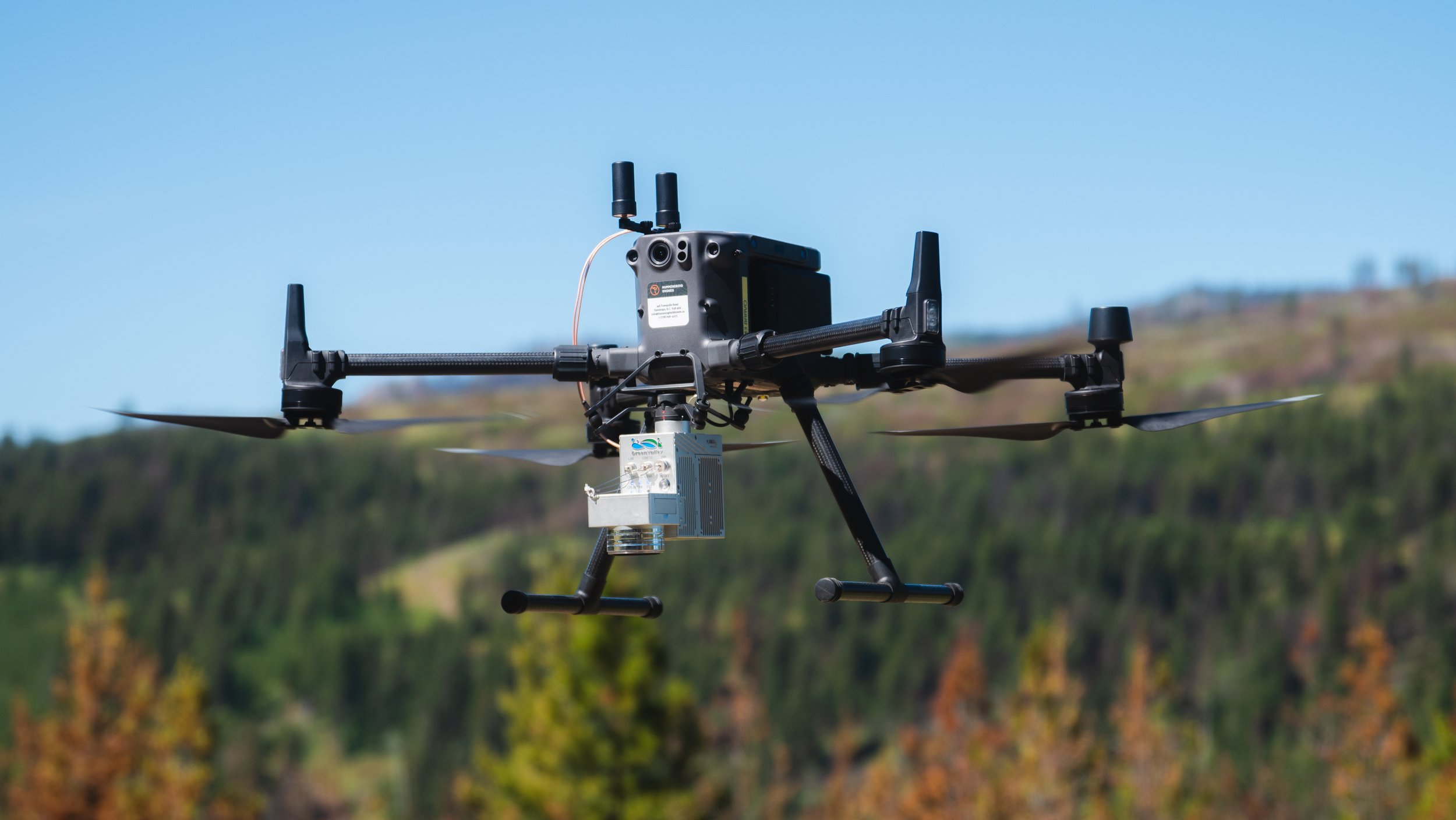
This LiDAR set up is used frequently by the Hummingbird crew!
While all these sensors are providing useful visible representations of our environments, drone senses can go beyond sight. For example, gas detection sensors can be mounted on drones and are used to "sniff out" and detect the presence of specific gases in the atmosphere. In areas with exposed hazardous chemicals that can cause harm to people without the proper protective gear, drones are useful because they can safely navigate these areas with little risk to the operator.
These sensors and cameras are just a few of our favourites, and it goes to show that the possibilities are endless. The advancements in drone sensors and the ability to gather data from an aerial perspective have opened up a wealth of new opportunities that continue to grow. The applications are extremely versatile, from capturing visual data with cameras to detecting gases in the atmosphere. Whether in agriculture, wildfire, or inspection, drones equipped with these sensors are revolutionising how we collect data and see the world.
-Nico Torchia, Crew Coordinator/Project Manager